Thursday 2nd September 1819

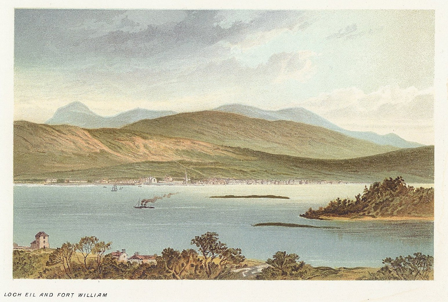
Thursday Sept 2nd About one o’clock we crossed the ferry & proceeded to Fort William to dinner 14 miles, the road which is excessively good lies over the banks of Loch Eil encompassed by fine mountains; Fort William is a small town with a pretty fort Major Cameron a very agreeable gentleman whom we met here showed us all over the it the Inn is very comfortable.
OBSERVATIONS & COMMENTS:
Fort William: The earliest recorded settlement on the site is a Cromwellian wooden fort built in 1654 as a base for English troops to "pacify" Clan Cameron after the Wars of the Three Kingdoms. The post-Glorious Revolution fort was named Fort William after William of Orange who ordered that it be built to control the Highland clans.

1889: Loch Eil and Fort William from, “Souvenir of Scotland: its Cities, Lakes, and Mountains.” Published by T. Nelson and Sons, London, Edinburgh and New York. https://www.mapsandantiqueprints.com/wp-content/uploads/2010/09/p-981-273-327-1000x675.jpg

2007: Fort William viewed from Corpach by Andrew R Palmer and licensed under the Creative Commons Attribution-ShareAlike 3.0 License. https://en.wikipedia.org/wiki/File:FortWilliam.jpg
The settlement that grew around it was called Maryburgh, after his wife Mary II of England. This settlement was later renamed Gordonsburgh, and then Duncansburgh before being renamed Fort William, this time after Prince William, Duke of Cumberland; known to some Scots as "Butcher Cumberland". https://en.wikipedia.org/wiki/Fort_William,_Highland

2011: Fort William Parade and the Duncansburgh MacIntosh Parish Church by Elizabeth B. Thomsen, the copyright holder. Licensed under the Creative Commons Attribution-Share Alike 4.0 International license. https://commons.wikimedia.org/wiki/File:FortWilliamParade.jpg

2005: Fort William High Street Lochaber High School band march down the High Street by Sarah Charlesworth, the copyright holder. This image was taken from the Geograph project collection and is licensed for reuse under the Creative Commons Attribution-Share Alike 2.0 Generic license. https://commons.wikimedia.org/wiki/File:Fort_William_High_Street_-_geograph.org.uk_-_987377.jpg
NOTE: Lucy and family were shown around the garrison by Major Cameron (the Cameron Clan was local to the area)
Below, artistic impression of Bonnie Prince Charlie’s march with his highland army along Loch Eil in 1746

1836: Passage of the Highland Army along the side of Loch Eil, 1746, by Thomas Allom (1804-72), engraved H. Griffiths, from "Scotland Illustrated" by William Beattie (1793-1875), published George Virtue https://antiquemaps.co.nz/products/passage-of-the-highland-army-loch-eil-1746
Loch Eil is a sea loch that opens into Loch Linnhe near the town of Fort William. The name of the Chief of Clan Cameron is spelt LOCHIEL, while the name of the loch is spelt LOCH EIL. Lochiel was a historic place east of Fassfern on the north shore of Loch Eil and home to Jacobite chieftain Donald Cameron, of Lochiel. https://en.wikipedia.org/wiki/Loch_Eil

2016: Eilean nan Craobh, once home to Lochiel, chief of Clan Cameron by Ronald Cameron, the copyright holder of this work, published under the Creative Commons Attribution-Share Alike 4.0 International license. https://commons.wikimedia.org/wiki/File:Eilean_nan_Craobh.jpg

2016: Loch Eil and head of Loch Linnhe from the slopes of Carn Mòr Dearg by Ronald Cameron, the copyright holder of this work, published under the Creative Commons Attribution-Share Alike 4.0 international license. https://commons.wikimedia.org/wiki/File:Loch_Eil_from_CMD.jpg
Can you help us?
Old Regency Prints, Pictures an Coaching maps: Do you have access to any prints or pictures showing what town and country would have looked like when Lucy travelled through? Any illustrations of what she would have seen in 1819 will enliven our research.
New Pictures: Do you have any modern pictures of the streets, buildings, gardens and views that would enable us to see the changes that two centuries have wrought?